Three complementary décor products are available for each middle and upper grade topic. Each product comes in a different format and provides a different content focus. Together, all three products offer a complete package of instructional resources:
Three complementary décor products are available for each middle and upper grade topic. Each product comes in a different format and provides a different content focus. Together, all three products offer a complete package of instructional resources:
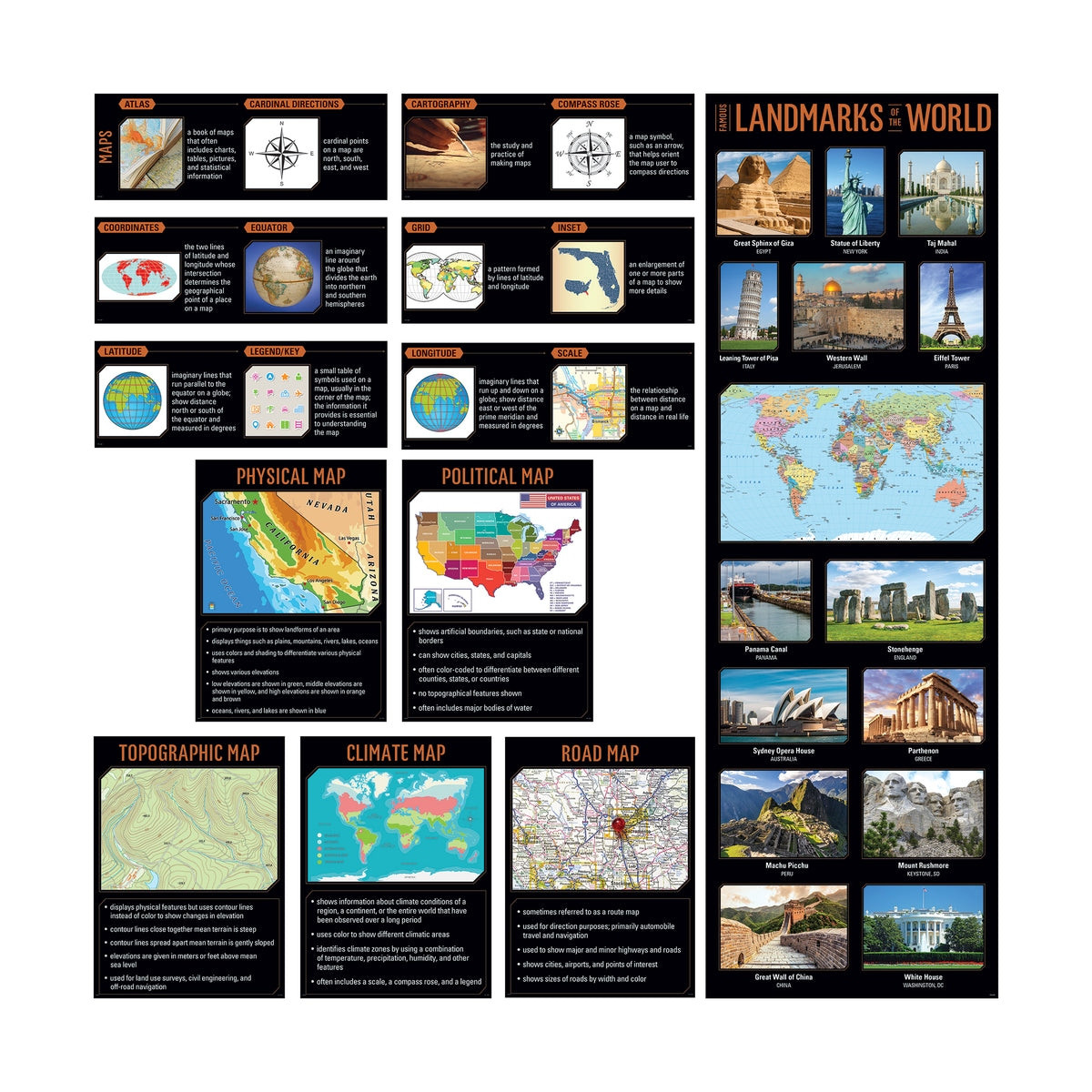
This Maps Essentials Pack covers these topics:
The resources in this set feature vivid, engaging photography alongside easy-to-read text to capture students' attention, reinforce instruction, and foster learning. They help bring content to life and create a stimulating, standards-based classroom environment.
Hang these resources as a reference for students during geography lessons. Use on a bulletin board, on a doorway, in a hallway, in the library, or anywhere students study.
Perfect for elementary school GATE programs, plus middle school and high school classrooms.
Pack contains:
Poster set also includes an instructional guide with lesson ideas, classroom activities, and a reproducible.

No customer reviews for the moment.
Three complementary décor products are available for each middle and upper grade topic. Each product comes in a different format and provides a different content focus. Together, all three products offer a complete package of instructional resources: